Introduction
Google Earth is your gateway to exploring the globe like never before. With its stunning 3D imagery and comprehensive mapping features, Google Earth allows you to virtually travel anywhere, discover new places, and gain unique perspectives of our planet. Whether you're planning a trip, conducting research, or simply satisfying your curiosity, which offers a world of possibilities.
Features of Google Earth:
❤ 3D Graphic Technology: Google Earth provides users with a fantastic 3D view of the world. This advanced graphic technology allows you to explore the planet in a visually stunning way, providing a more immersive and realistic experience.
❤ Satellite Imagery: With Google Earth, you can examine the entire globe using satellite imagery. This means you can explore every corner of the world and view high-resolution images of different landscapes, landmarks, and cities from above.
❤ Street View: Dive in for a 360° perspective with Street View. This feature allows you to virtually walk through streets and neighborhoods, giving you a street-level view of various locations around the world. You can explore popular tourist destinations, historical sites, and even see what your own house looks like from the street.
❤ Voyager Guided Tours: It offers Voyager, a collection of guided tours created by renowned organizations like BBC Earth, NASA, National Geographic, and more. These tours take you on virtual journeys to different parts of the world, providing educational and entertaining content to enhance your exploration.
Tips for Users:
❤ Zooming In and Out: Use the zoom feature to get a closer look at specific areas or landmarks. You can easily zoom in and out of hundreds of cities without having to physically go there, allowing you to explore different parts of the world with ease.
❤ Knowledge Cards: Pay attention to the knowledge cards that appear while using Google Earth. These cards provide useful information about various places and landmarks, giving you the opportunity to learn new things as you explore.
❤ Create Your Own Stories: It allows you to create immersive maps and stories. Take advantage of this feature to document and share your own experiences and discoveries with others.
⭐ Explore In 3D – Experience Realistic Views Of The World
Discover the world in breathtaking detail with Google Earth’s 3D imagery. Fly over cities, landmarks, and natural wonders to experience them as if you were there. The app’s high-resolution satellite images and 3D terrain bring locations to life, providing an immersive and realistic view of our planet’s diverse landscapes.
⭐ Virtual Tourism – Visit Landmarks And Attractions
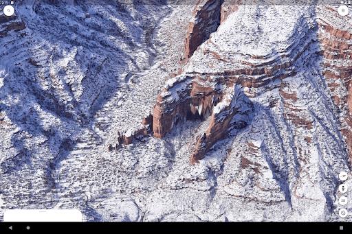
Google Earth enables you to explore famous landmarks, historical sites, and tourist attractions from the comfort of your home. Take a virtual stroll through iconic locations like the Eiffel Tower, the Great Wall of China, or the Grand Canyon. With Google Earth, you can visit and learn about the world’s most remarkable destinations without leaving your seat.
⭐ Street View – Get A Close-Up Look At Any Location
With Google Earth’s Street View feature, you can get an up-close look at streets, neighborhoods, and landmarks. Navigate through detailed panoramic imagery to explore places as if you were walking down the street. Street View provides valuable context and detail, making it a powerful tool for planning trips or exploring new areas.
⭐ Measure Distances And Areas – Plan And Analyze Easily
Google Earth includes tools for measuring distances and areas, making it easy to plan and analyze geographic spaces. Whether you’re calculating the distance between two points, measuring the area of a park, or assessing the size of a property, Google Earth’s measurement tools provide accurate and useful information for your projects and interests.
⭐ Customized Maps – Create And Share Your Own Visions
Create personalized maps with Google Earth’s customization features. Add markers, draw paths, and annotate locations to design custom maps that fit your needs. Share your maps with friends, family, or colleagues, and use them for planning events, trips, or projects. Google Earth allows you to visualize and communicate your ideas effectively.
⭐ Explore Earth’S History – View Historical Imagery
Dive into the past with Google Earth’s historical imagery feature. Compare current satellite images with those from previous years to observe changes over time. This feature is invaluable for research, education, and understanding the evolution of landscapes and urban development.
- No virus
- No advertising
- User protection
Information
- File size: 11.00 M
- Language: English
- Latest Version: 10.61.0.9
- Requirements: Android
- Votes: 242
- Package ID: com.google.earth
- Developer: Google LLC
Screenshots
Explore More
Level up your phone with the most helpful tools for Ultimate productivity. From image editors and file managers to task trackers and weather widgets, these top-rated essentials make everyday tasks smooth and easy. Get organized, save time and optimize workflows with a powerful toolbox by downloading these editor's choice utilities today. Your phone will never be the same again!

А2 Сервис

OCR Instantly

新北校園通

قرآن | ورش التجويد

Mockitup

Headify: AI Headshot Generator

Body Editor - AI Photo Editor

Utah Hunting and Fishing


Comment
Rogner2000
With current update, almost all feature are gone. This app has become horrible and worthless.
2024-09-17 10:46:18
Panagiotis Papaioannou
There a no names of places, borders etc visible regardless of zoom level or the fact that I have chosen to see everything in the settings.
2024-09-16 18:12:57
Nolawi Noli
It is actually great app I've been used it more than 6 years it is a great app it have good graphics it feels like a game like realistic game I spend a lot of times hours on this app it's allow me to see some of the part of the world
2024-09-16 14:49:04
Gavin Russell
This App Is Brilliant You Can Explore Places On Your Phone Before You Visit Them For Real. It Also Gives You The Freedom To Look At Some Of The More Remote And Exotic Locations On Earth. Luv it
2024-09-16 03:13:30
Greg O
Don't know where all the 5-star reviews are coming from, it constantly crashes, if it even loads at all.
2024-09-15 05:32:39
Arvin moreno
it's not updated, when you search for the manual you won't find it, but if you search for it, it will show you where,but it's nice cause it is clearly to see..
2024-09-14 11:31:10
shreyas gavand
There is no option for calculation of land in square metre, in previous version it is available, why remove from this version, this is very helpful for calculation of land area, please add in as soon as possible
2024-09-13 04:21:02
Dick Richards
It's a good app. It's educational and you can go places that you never been before and I would recommend it to all my friends and family. Thanks for the app. Keep up the good work,Fr. Dick Richards
2024-09-13 03:27:10
Hexi Lee
District All of the red district can't be showed in each old version when I search for any communes/departments,or counties.I have to update this app but I can't continue to use it on my ipad beacuse of the ios sysyem.
2024-09-13 02:45:12