


Introduction
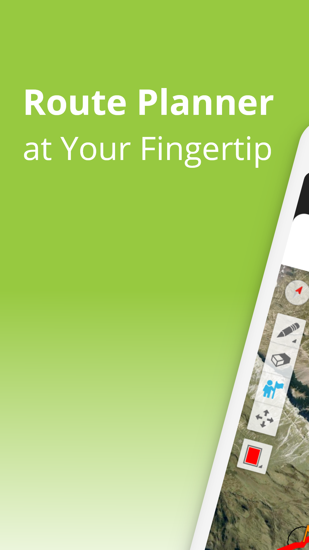
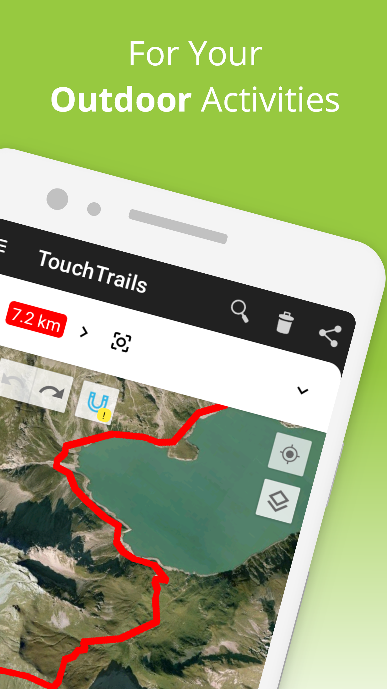
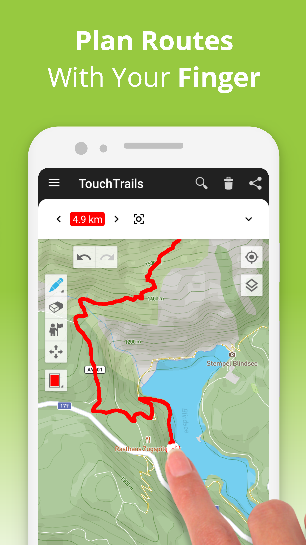
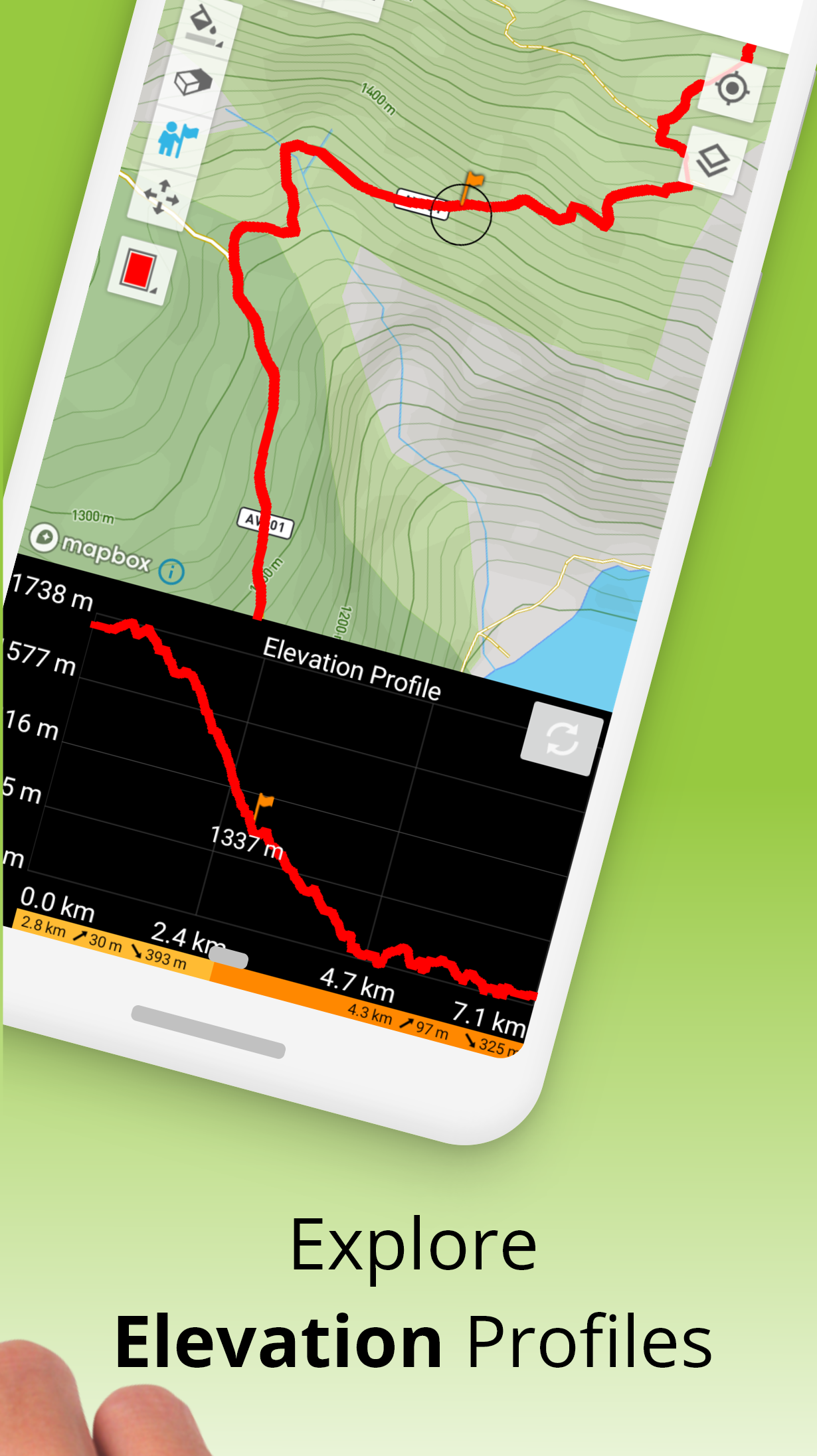
TouchTrails: Route Planner is a versatile app designed for hikers, runners, and outdoor enthusiasts to plan and track their routes efficiently. With TouchTrails: Route Planner, you can create custom trails, view topographic maps, and monitor distance, elevation, and estimated time. The app offers an interactive and user-friendly platform for planning safe and enjoyable outdoor adventures.
Features of TouchTrails: Route Planner:
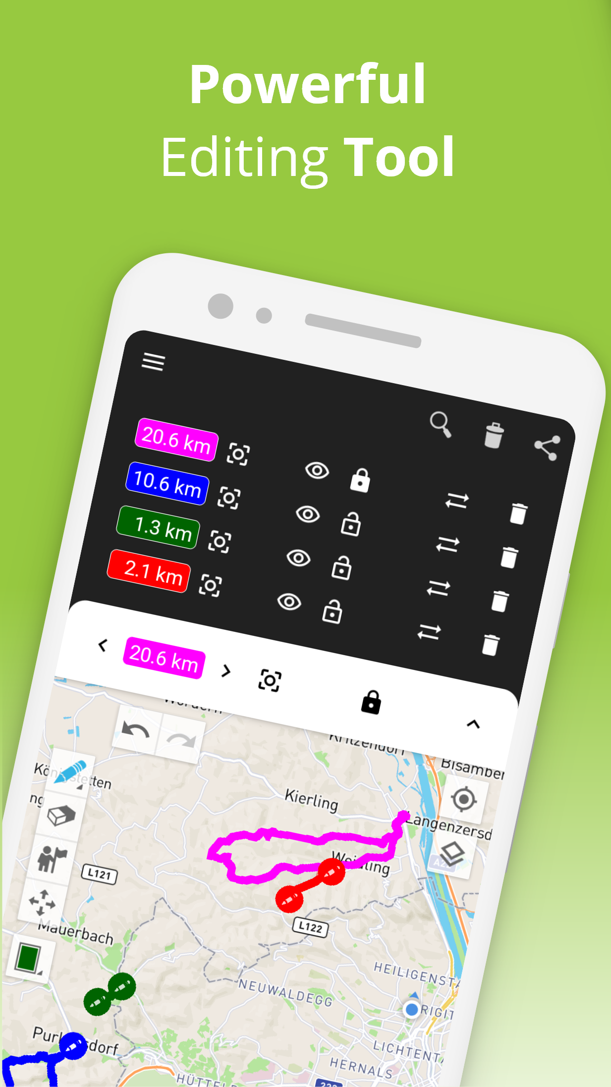
1. The app allows users to create and customize routes for hiking, running, cycling, and other outdoor activities.
2. TouchTrails: Route Planner provides detailed maps, including topographic views, trails, and points of interest.
3. Users can track distance, elevation gain, and estimated duration of their planned routes.
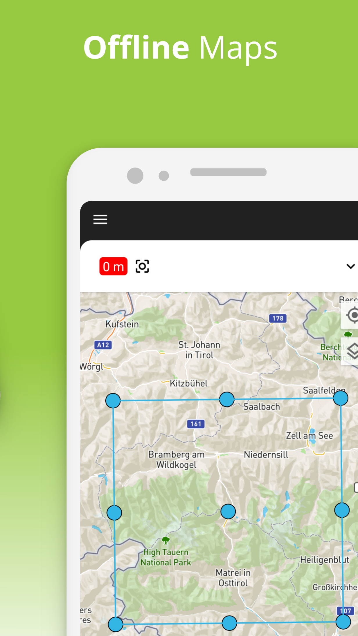
4. The app supports offline maps so users can navigate even in areas without internet coverage.
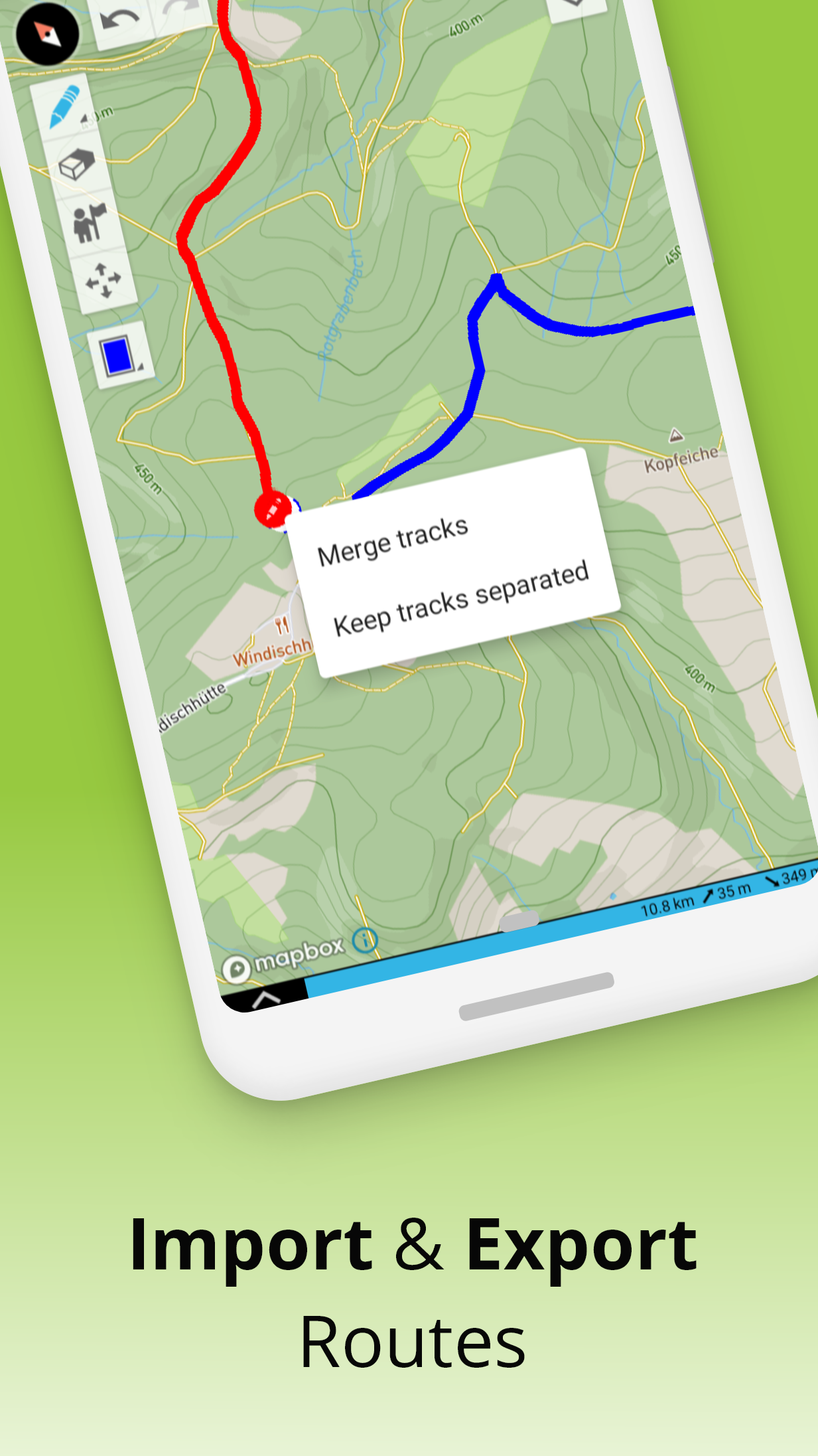
5. A simple and intuitive interface makes planning, saving, and sharing routes quick and easy.
Playing Tips:
1. Plan your route in TouchTrails: Route Planner before heading out to ensure safety and efficiency.
2. Use topographic maps to identify elevation changes and prepare for challenging terrain.
3. Enable offline maps if you will be in areas with limited or no internet access.
4. Track your distance and elevation during the activity to monitor performance and adjust pace.
5. Save and share your favorite routes with friends or the TouchTrails community for inspiration.
Conclusion:
TouchTrails: Route Planner is a powerful app for planning and navigating outdoor activities like hiking, running, and cycling. With customizable routes, detailed maps, performance tracking, and offline support, it ensures a safe and enjoyable adventure. If you want a reliable tool to plan and track your outdoor routes, TouchTrails: Route Planner is an excellent choice.
- No virus
- No advertising
- User protection
Information
- File size: 34.80 M
- Language: English
- Latest Version: 2.12.0
- Requirements: Android
- Votes: 110
- Package ID: com.wolfgangknecht.sketchatrack
- Developer: pixelclash
Screenshots


Comment