

Introduction
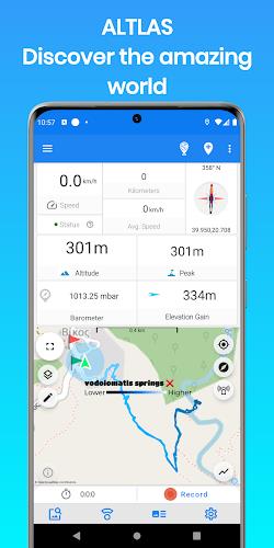
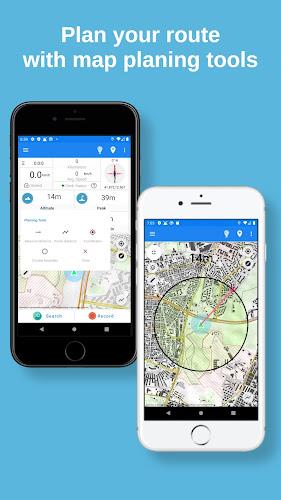
ALTLAS: Trails, Maps & Hike is the ultimate app for outdoor enthusiasts and adventure-seekers alike. Whether you're into hiking, biking, trekking, or even flying, this app has got you covered. With its accurate altimeter and tracking information, you can explore, record, and share your activities with ease. It also features a unique database of trails recorded by users worldwide, ensuring that you find the best hiking routes wherever you go. The app provides essential data like elevation, peak points, barometric pressure, speed, and more. Plus, it alerts you against altitude limitations, ensuring your safety during your adventures. Join the community and discover new routes and places, and don't forget to check out the additional features like weather forecast, steps and calorie calculator, and offline maps. Take your outdoor experiences to new heights with it. Download it now and start your next adventure!
Features of ALTLAS: Trails, Maps & Hike:
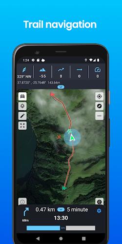
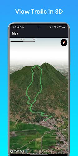
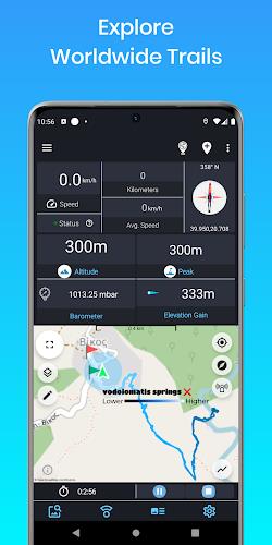
❤️ Elevation finder and activity tracker: This app allows you to track your activities and find accurate elevation information. Whether you're hiking, cycling, or skiing, you can easily monitor your performance.
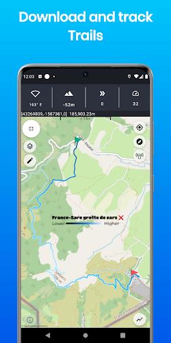
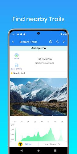
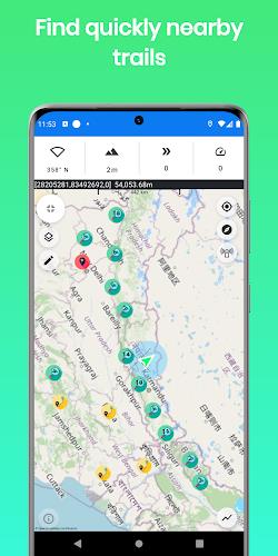
❤️ Database of trails around the world: Explore a unique database of trails recorded by users, so you can discover the best hiking trails no matter where you are.
❤️ Comprehensive tracking information: The app provides detailed data such as altitude, peak points, barometric pressure, speed, and more, giving you a complete overview of your activities.
❤️ Suitable for various activities: Whether you enjoy walking, trekking, flights, cycling, skiing, or biking, this app is suitable for a wide range of outdoor activities.
❤️ Community-based platform: Join a community that shares routes and places, allowing you to discover new trails and connect with other outdoor enthusiasts from around the world.
❤️ Planning and navigation tools: This app not only tracks your activities, but it also offers features like measuring routes, estimating time of arrival, and providing circular boundaries, making it a comprehensive planning and navigation tool.
Conclusion:
The ALTLAS: Trails, Maps & Hike app is the ultimate tool for outdoor enthusiasts. With its features like elevation tracking, a vast trail database, accurate tracking information, and a community-based platform, this app is a must-have for anyone looking to explore and record their activities. Download now and start your adventure today!
- No virus
- No advertising
- User protection
Information
- File size: 31.38 M
- Language: English
- Latest Version: 5.0.7
- Requirements: Android
- Votes: 100
- Package ID: altitude.alarm.erol.apps
Screenshots
Explore More
Level up your phone with the most helpful tools for Ultimate productivity. From image editors and file managers to task trackers and weather widgets, these top-rated essentials make everyday tasks smooth and easy. Get organized, save time and optimize workflows with a powerful toolbox by downloading these editor's choice utilities today. Your phone will never be the same again!

新北校園通

قرآن | ورش التجويد

Mockitup

Headify: AI Headshot Generator

Body Editor - AI Photo Editor
Utah Hunting and Fishing

Coral Travel - турагентство

geteduroam


Comment
awrang zaib
One the best app I have ever seen.. ❤️❤️❤️
2024-04-24 12:15:53
Tom Wylie
Great app. Easy to use.
2024-04-23 17:11:16
said saba
The only app who give me the True altitude
2024-04-21 21:41:27
Hussein Tarawneh
Not bad, power drainer though (╯︵╰,)
2024-04-21 12:07:02
A Google user
Great app, very happy.
2024-04-19 07:16:13
A Google user
Nice app easy to use
2024-04-18 18:34:42
allhailalona
U can't import kmz files
2024-04-18 14:53:32
Chaker Hakim
Very good experience with this App
2024-04-17 22:23:46
Ed Gee
Love this! It works!
2024-04-17 18:07:38